Location Quiz

Use this forum to talk about the railways in and around Bristol, or for any off-topic stuff you want to share. Also request photos and information that you are missing.

Moderators: AJR, James

Robin Summerhill
regular
Posts: 884
Joined: Thu Apr 16, 2009 8:19 pm
Location: Back in Wiltshire again...
Contact:

Post by Robin Summerhill »

A long shot, and it flies in the face of much of my "investigation" of yesterday (so I won't be applying for a job in CID :mrgreen: ), but Wells is a possibility - where the roundabout is now at the junction of Strawberry Way and Priory Street.

A 1904 OS map on this site http://www.old-maps.co.uk/maps.html shows a fairly large building identified as an infirmary at about the same distance from the railway as shown in the photograph.

This infirmary is now the Priory Health Park.

What does anybody else think?
jules
regular
Posts: 827
Joined: Sat Mar 12, 2005 3:36 pm
Location: Bristol, UK

Post by jules »

Wells is a possibility
A very distinct possibility! I've looked at the same old map. Could that inverted V roof that looks like it is in the trees be the signal box shown on the map? Seems a bit distorted, but it is in the approximate correct position. The angle of road/railway could be that we are looking toward the houses on Rowdens Road and the main road is well off to the right on the other side of the line?

So, if it is Wells, this was the S&DJR station, not the GWR one. Maybe why it all looks a bit, well, odd.

I guess all we need now is a modern look at The Priory buildings to try and identify them and the problem is quite possibly solved :D Map also mentions these buildings were the Wells Workhouse, so the appearance ties in too.

Also, it would have been an obvious day trip from Yatton on that motorbike :D
jules
regular
Posts: 827
Joined: Sat Mar 12, 2005 3:36 pm
Location: Bristol, UK

Post by jules »

Looking hopeful. Look at this:

http://www.srarchitects.co.uk/healthcar ... riory.html

See the second picture? The windows certainly seem to macth. Short ones at the top, taller ones in between ...

:D :D
jules
regular
Posts: 827
Joined: Sat Mar 12, 2005 3:36 pm
Location: Bristol, UK

Post by jules »

Early S&DJR disc & cross bar signal:

Image

The lamp looks like a larger version of the one on our crossing gate :D
jules
regular
Posts: 827
Joined: Sat Mar 12, 2005 3:36 pm
Location: Bristol, UK

Post by jules »

Wells Priory Road Signal Box

Image

Could it be one of the inverted V roof outlines to the left?

Image

This was re-modelled in the 30's, the date of this diagram, so our photo would have been 20 or so years before that. It would put the crossing somewhere in the vicinity of points No. 13.

I need to go for a beer!! :shock:
AndyK
regular
Posts: 192
Joined: Thu Oct 06, 2005 1:50 pm
Location: Redland
Contact:

Post by AndyK »

The Wells idea is certainly persuasive but, if I may play devil's advocate :twisted:

a. The view across the railway towards the infirmary would be south-facing whereas the photo appears to be facing north

b. If we're assuming that the road we are on is Glastonbury Road, the actual crossing was just about at right angles and had four short gates. And the GWR Wells East Somerset signal box was right next to the crossing and might be expected to be seen in the view.
Andy Kirkham
Robin Summerhill
regular
Posts: 884
Joined: Thu Apr 16, 2009 8:19 pm
Location: Back in Wiltshire again...
Contact:

Post by Robin Summerhill »

jules wrote:I guess all we need now is a modern look at The Priory buildings to try and identify them and the problem is quite possibly solved
You can see the front (east facing) side of the building in Google Maps (sorry, I've yet to fathom how to post a link to a specific point in Google maps - any help would be appreciated!).

When I looked at it there, it was then that I thought the possibility was quite strong, because of the appearance of the stonework, the windows, the roof line and the chimneys. Couple that to the shape of the building shown on the 1904 map (the photograph seems to suggest that there are two rooflines on that building, one behind the other) and it becomes more of a "runner."

You have of course to remember that the photograph is getting on for 100 years old, so there may have been many alterations/ extensions to the building in the intervening years, but the "basics" will still be much as they were back then.

In response to Andy Kirkham, although I said in an earlier post that I thought the phorographer was facing north in the morning, he could just as easily have been facing south in the afternoon/ evening. However, given the state of development of photography at the time, he (I am assuming it was a "he" - did they let women loose with cameras in those days :mrgreen: ) would have had to be very careful in his positioning when facing in the general direction of the sun.

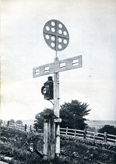
We also probably need to bear in mind that the purpose of taking the photograph was not to show the surroundings, but to feature on the subjects. It could be that railway infrastructure such as signalboxes may have been deliberately avoided by the photographer so that they did not detract from the main point of the photo.

All that said, I will not be putting any money on this suggestion down the bookies :mrgreen:
jules
regular
Posts: 827
Joined: Sat Mar 12, 2005 3:36 pm
Location: Bristol, UK

Post by jules »

Thanks for the extra input Robin

I am getting pretty convinced we have it right - quite an achievement really.

As you say, a lot of changes will have taken place, especially as the track layout was totally re-modeled in the 1930's.

I am surprised that the level crossing does not appear on the signal box diagram, but perhaps it was manually operated. It was a very long gate, after all. Perhaps as such, it wasn't interlocked with the signaling? Any one who knows about early 1900's S&DJR signaling protocols would be very welcome to comment.

Also, the number of tracks to be crossed (as per the diagram) would account for the very long gate, even though in the photograph, it at first appeared to be a single track railway. A box diagram from pre-remodeling would be helpful I guess, but I've not been able to find one ...

Thanks to all for all your suggestions :D
p.pillcreek@virgin.net
watcher
Posts: 5
Joined: Sat Jan 31, 2009 5:15 pm
Location: Pill, North Somerset

level crossing with old motor bikes

Post by p.pillcreek@virgin.net »

Not Street, as the nearest level crossing would have been at

Glastonbury, where the station for Street was ''Glastonbury and Street''

station.
nickt
regular
Posts: 248
Joined: Tue Feb 12, 2008 6:54 pm
Location: South of Bath

Post by nickt »

I am intrigued by pinnacle on the building. As wells Priory hospital is mainly intact perhaps a tour along road past sherston inn on google maps street level might help. I go past this point fairly often but not totaly convinced. Lamp on crossing gate post looks of very similar design to ones at heritage railway not a million miles from wells.
Robin Summerhill
regular
Posts: 884
Joined: Thu Apr 16, 2009 8:19 pm
Location: Back in Wiltshire again...
Contact:

Post by Robin Summerhill »

nickt wrote:I am intrigued by pinnacle on the building
I looked closely at that in the original photograph as I initially thought it would be of great significance in identifying the building. However, by the look of it, I hazarded a guess that it would have once been a bell housing, and just the sort of thing that might well have been removed at some stage, especially if it no longer housed a bell :mrgreen:

In the days before planning laws and listed building status (which only actually date from the 1930s/40s), if something like that ever needed some repair work it would have been far cheaper to remove it than spend any money on it. Thats how things were done in those days.

More photographs of the building here: http://www.workhouses.org.uk/index.html ... ells.shtml I don't really know the area intimately (although I have been down that road quite a few times in the last half century ;) ), so I don't know which elevations we are looking at, or of course the dates of the photographs (they show copyright 2000 but that might not be when they were actually taken). Even so they do seem to support the contention that this photograph does indeed show this building in the background.

You will also notice on the OS extract, on that web page, that there was a non-railway building at the side of the road immediately south of the level crossing. This, I suspect, is the building we see partially obscured by trees in the photograph.
nickt
regular
Posts: 248
Joined: Tue Feb 12, 2008 6:54 pm
Location: South of Bath

Post by nickt »

I am wondering when the Tinknels Agricultural building ( built from brick)was built and whether originaly railway related. The photo I guess pre dates the building.
One other wild card I would like to throw into the mix is the road crossing at Shepton Mallet ( just a little way up from Charlton crossroads ). I havent seen any photos of this crossing but there are / were old large buildings in town. A number of brewerys and the Anglo Bavarian trading estate.
Ok that was just a shot in dark, building in photo looks very similar to Priory at wells but something doesnt quite add up. :?
Robin Summerhill
regular
Posts: 884
Joined: Thu Apr 16, 2009 8:19 pm
Location: Back in Wiltshire again...
Contact:

Post by Robin Summerhill »

nickt wrote: I am wondering when the Tinknels Agricultural building ( built from brick)was built and whether originaly railway related. The photo I guess pre dates the building.
My speciality is private housing, not retail/ industrial buildings but, by the look of it, I would say it dates from the 1930s. It doesn't appear to me to have any railway ancestry, and I say that for two similar reasons:

1. The frontage to Glastonbury Road looks fairly typical of a retail/ industrial building built in 1930s, particularly in respect of the windows.

2. There is much more window area in the side elevation (facing Strawberry Way - have a look at it in Google Maps) than I have ever seen in a railway building other than a purpose-built office block. And the railway wouldn't have built one of those in Wells in the 30s :mrgreen:
nickt wrote:One other wild card I would like to throw into the mix is the road crossing at Shepton Mallet ( just a little way up from Charlton crossroads ). I havent seen any photos of this crossing but there are / were old large buildings in town. A number of brewerys and the Anglo Bavarian trading estate.
This site again http://www.old-maps.co.uk/maps.html (enter Shepton Mallet in the search box, click on the site of the crossing to move the pointer, then select one of the pre WW2 maps from the selection on the right) shows that this was in the country in the early years of the 20th century, and there were no buildings which even closely resemble the one we've been trying to identify.

You can also see this in Google Maps - if you go to Whitstone Road Shepton Mallet (the end of the cycle path on the former railway formation is quite clear) and pan around 360 degrees, none of the buildings that were probably there during WW1 appear in the original photograph
Robin Summerhill
regular
Posts: 884
Joined: Thu Apr 16, 2009 8:19 pm
Location: Back in Wiltshire again...
Contact:

Post by Robin Summerhill »

jules wrote:Thanks for the extra input Robin

I am getting pretty convinced we have it right - quite an achievement really.

As you say, a lot of changes will have taken place, especially as the track layout was totally re-modeled in the 1930's.

I am surprised that the level crossing does not appear on the signal box diagram, but perhaps it was manually operated. It was a very long gate, after all. Perhaps as such, it wasn't interlocked with the signaling? Any one who knows about early 1900's S&DJR signaling protocols would be very welcome to comment.

Also, the number of tracks to be crossed (as per the diagram) would account for the very long gate, even though in the photograph, it at first appeared to be a single track railway. A box diagram from pre-remodeling would be helpful I guess, but I've not been able to find one ...

Thanks to all for all your suggestions :D
I've looked again on the Old Maps site http://www.old-maps.co.uk/maps.html

Enter Wells in the search box, select Wells Somerset when prompted, then look at the 1903 pre WWII option on the right hand side. Then zoom in on the crossing itself.

Before the remodelling, there was actually only a single track that crossed the road, and there appears to be a roadway/ area of tarmac on the north east side that gave access to the goods shed/ gas works.

You can virtually pinpoint where the photographer would have stood and positioned his subjects so as to not include the S&D station, whilst at the same time getting the angle on the hospital in the background that we see in the photograph.

I think I've finally changed my mind - I would put money on this being the location :mrgreen:
jules
regular
Posts: 827
Joined: Sat Mar 12, 2005 3:36 pm
Location: Bristol, UK

Post by jules »

I've reported back the location as Wells Priory Road to the gentleman that originally found the box of photos, with a link to this thread :D

He was most appreciative and impressed by the BRA detective team!

However, for Robin's benefit (and time saving) I shall think long and hard before recklessly posting another "Location Quiz".

Thanks all for your input!
Locked